KANCHENJUNGA REGION TREKKING
AEON ADVENTURE NEPAL · KANCHENJUNGA REGION · EASTERN HIMALAYA · TREKKING · CULTURE · NATURE
Explore the Kanchenjunga Region
Remote Eastern Himalayan Wilderness, Glaciers & High Mountain Trails
WHERE EVERY JOURNEY BECOMES A STORY
The Kanchenjunga Region lies in the far-eastern Himalaya of Nepal, mainly within Taplejung District, Koshi Province, along the Nepal–Sikkim (India) border. It is centred on Mount Kanchenjunga (8,586 metres), the world's third-highest mountain, and the landscapes protected by Kanchenjunga Conservation Area (KCA). Remote valleys, high ridgelines, glaciers, alpine lakes and traditional mountain settlements define this exceptional Himalayan destination.
Kanchenjunga is known for its long, remote trekking routes, dramatic mountain scenery and rich cultural and ecological diversity. The region offers a quieter wilderness experience through forested valleys, terraced villages, high pastures and glacial terrain, with demanding trails far from Nepal's busier trekking corridors.
Geography, Himalayan Range & Natural LandscapesKanchenjunga belongs to the Eastern Himalaya and forms the Kanchenjunga Himal / Kanchenjunga massif—not the Mahalangur Himal range. The massif straddles the Nepal–Sikkim border, while Nepal's trekking approaches lie mainly in Taplejung. Landscapes extend from subtropical river valleys and temperate forests to alpine meadows, glaciers and snow-covered peaks.
The region is dominated by Mount Kanchenjunga (8,586 m), with neighbouring high peaks such as Jannu (Kumbhakarna, 7,710 m) and a spectacular network of ridges, ice fields and mountain valleys. Elevation and terrain change sharply from lower settlements to remote high-altitude country.
Kanchenjunga North & South Base CampsThe classic Kanchenjunga Circuit Trek links the northern and southern approaches. The north route commonly travels from the Taplejung/Sekathum area through Amjilosa, Gyabla, Ghunsa, Kambachen and Lhonak towards Pangpema (North Base Camp, approximately 5,140 m). It passes through forests, traditional villages and increasingly rugged glacial terrain.
The southern approach generally follows Yamphudin, Tortong, Tseram and Ramche towards Oktang (South Base Camp viewpoint, approximately 4,700–4,730 m). Route order and duration vary by itinerary, trail conditions and local arrangements.
Mountain Passes, Valleys & Traditional SettlementsThe circuit's high-pass section may include Sele La, Mirgin La and Sinion La, depending on route and conditions. Important valleys and river corridors include the Ghunsa, Yangma, Kabeli and Tamor landscapes. Ghunsa and Olangchungola are notable high-mountain settlements along regional trekking routes.
Traditional footpaths connect villages, cultivated hillsides, forests and seasonal pastures. As trails climb into remote alpine areas, settlements become sparse and services increasingly limited.
Glaciers, Alpine Lakes & High Mountain LandscapesThe Kanchenjunga landscape is shaped by major glaciers and rugged glacial valleys, including the Yalung, Tiptala and Ramjer glacier areas. Moraine fields, rocky ridges, ice formations and snow-covered slopes create striking high-altitude scenery around the massif.
Regional alpine lakes include Nangama, Tcherchen, Pabuk, Sinjema, Hans Pokhari, Nag Pokhari, Timbung Pokhari and Tin Pokhari. Conditions in high terrain can change rapidly; snow, weather and trail exposure require flexible trekking plans.
Culture, Local Communities & Mountain HeritageThe region is home to diverse communities, including Limbu/Kirati communities in lower areas and Sherpa and Bhote communities in higher mountain settlements, alongside other local groups. Languages, traditional livelihoods, village architecture and local customs contribute to Kanchenjunga's cultural character.
Visitors may encounter Buddhist monasteries and cultural sites, including Diki Chholing Gumba, as well as traditional village life in places such as Ghunsa and Olangchungola. Respect for community practices, religious places and local guidance is essential.
Forests, Wildlife & BiodiversityKanchenjunga Conservation Area protects a wide range of habitats, from lower subtropical forests to temperate woodland, rhododendron forests, conifer stands, alpine meadows and high Himalayan terrain. Vegetation includes oak, maple, birch, rhododendron, juniper, larch, orchids and alpine plants, changing markedly with elevation.
Wildlife includes elusive species such as the snow leopard, red panda, Himalayan black bear, musk deer, blue sheep and Tibetan wolf, as well as diverse birdlife. Sightings are never guaranteed and depend on habitat, season and chance.
Mountain Views & PhotographyThe Kanchenjunga Region offers dramatic views of Kanchenjunga's immense massif, Jannu, glacial valleys, high ridges and alpine lakes. The north and south approaches reveal different perspectives of the mountain, from forested trails and villages to expansive high-altitude panoramas.
Clear mornings and favourable weather can provide impressive mountain views, while village trails, monasteries, bridges, forests and local life offer additional photographic subjects. Visibility varies with season, clouds and mountain conditions.
Peak Climbing & High-Altitude AdventuresMount Kanchenjunga (8,586 m) is a major mountaineering objective and an extremely demanding expedition peak. The wider massif includes technical climbing terrain and other high summits such as Jannu. Trekking to the base-camp viewpoints is distinct from a technical summit expedition.
High-altitude climbing requires technical preparation, specialist equipment, appropriate permits and experienced expedition support. Remote trekking also requires careful planning, acclimatisation and respect for changing mountain conditions.
Best Time to Explore KanchenjungaSpring (March–May) and autumn (September–November) are generally the principal trekking seasons. Spring brings blooming rhododendrons in forest areas, while autumn often offers clearer mountain views and favourable trekking conditions.
Winter (December–February) can bring severe cold and snow at higher elevations. The monsoon (June–August) brings heavy rainfall, cloud, landslide risks and challenging trail conditions, especially in lower valleys. Conditions vary by altitude and year; check current local information before departure.
Access, Accommodation & Trekking InfrastructureTaplejung is the main regional access hub for Kanchenjunga trekking. Travellers commonly reach the area by road or through eastern Nepal travel connections, then continue by local road transport towards trailheads such as Sekathum or Yamphudin, depending on the itinerary. Road conditions, weather and transport availability can affect access, so arrangements should allow flexibility.
Accommodation along the classic routes is generally in basic teahouses, local lodges and simple trekking stays. Facilities become more limited in remote and higher sections, where food choices, electricity, communication and lodging standards may be basic and seasonal.
Altitude, Acclimatisation & Mountain SafetyKanchenjunga trekking rises from lower valleys to remote high mountain terrain, reaching approximately 5,140 m at Pangpema (North Base Camp). Trails include steep ascents, long walking days, high passes and sections far from emergency services, making acclimatisation and preparation essential.
Gradual ascent, suitable acclimatisation, awareness of altitude-related symptoms, hydration and flexible itineraries are important. Trekkers should use qualified local support and follow current advice about weather, trail conditions and health.
Responsible Tourism & ConservationKanchenjunga Conservation Area is a sensitive mountain ecosystem with important natural and cultural heritage. Responsible trekking includes staying on established trails, carrying out waste, avoiding disturbance to wildlife, respecting local customs and protecting forests, water sources and fragile alpine habitats.
Visitors can support local communities by using local guides, porters, accommodation and transport services. Respectful travel and careful use of limited mountain resources help conserve Kanchenjunga's wilderness and sustain community livelihoods.
Discover the Kanchenjunga Region with AEON Adventure NepalFrom the classic Kanchenjunga Circuit and Pangpema North Base Camp to the southern Oktang viewpoint, high passes, alpine lakes and traditional mountain villages, the Kanchenjunga Region offers an exceptional wilderness trekking experience.
Explore remote settlements, walk through rich forests, cross dramatic mountain terrain and discover the landscapes beneath the world's third-highest peak. Kanchenjunga reveals a spectacular and culturally rich side of Nepal's Eastern Himalaya—where nature, heritage and adventure come together.
A remote Eastern Himalayan wilderness — discover Kanchenjunga's base-camp trails, high passes, alpine lakes, local heritage, forests, glaciers and mountain wildlife.
DREAM. EXPLORE. DISCOVER.
WHERE EVERY JOURNEY BECOMES A STORY
KANCHENJUNGA REGION HIGHLIGHTS
From Mount Kanchenjunga and its dramatic north and south base-camp viewpoints to remote valleys, protected wilderness, glacial landscapes and remarkable Eastern Himalayan scenery, discover the defining highlights of the Kanchenjunga Region.
Mount Kanchenjunga · 8,586 m
Stand beneath the dramatic pyramid of Kanchenjunga, one of the planet’s most imposing Himalayan summits.
EXPLORE →
Pangpema North Base Camp · 5,140 m
Trek towards Pangpema for vast views of Kanchenjunga, glaciers and surrounding high peaks.
EXPLORE →
Ghunsa & Yangma Valleys
Discover the Ghunsa Valley, mountain villages, forests and striking high-altitude scenery.
EXPLORE →
Kanchenjunga Conservation Area Area
Explore the protected habitats of Kanchenjunga Conservation Area, from forests to alpine meadows and glaciers.
EXPLORE →
Ghunsa Valley
Follow the spectacular Arun river corridor through lush hills, villages and changing Himalayan landscapes.
EXPLORE →
Yalung Glacier
Experience the rugged ice and moraine scenery surrounding the upper Ghunsa & Yangma Valleys and Kanchenjunga Base Camp.
EXPLORE →
Oktang
Reach the Oktang viewpoint for dramatic perspectives of Kanchenjunga's southern glaciers and peaks.
EXPLORE →
Oktang
Explore Olangchungola, a traditional high-mountain settlement with distinctive local heritage.
EXPLORE →Explore Kanchenjunga’s towering summit, remote valleys, glaciers, protected landscapes and remarkable eastern Himalayan trails.
Image sources: Kanchenjunga · Pangpema · Ghunsa Valley · Conservation Area. Verify image availability and licenses before publishing.
ENQUIRE NOW →
KANCHENJUNGA REGION ADVENTURES
Discover remote eastern Himalayan trails, the north and south base camps of Mount Kanchenjunga, and ambitious high-altitude expeditions in Nepal’s far east.
KANCHENJUNGA REGION TREKKING
Remote trails, traditional mountain settlements and spectacular views of the world’s third-highest mountain.
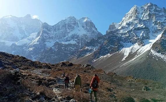
Kanchenjunga South Base Camp Trek
Trek through the Yalung Valley toward Ramche and Oktang, with breathtaking views of the southern Kanchenjunga massif.
EXPLORE →
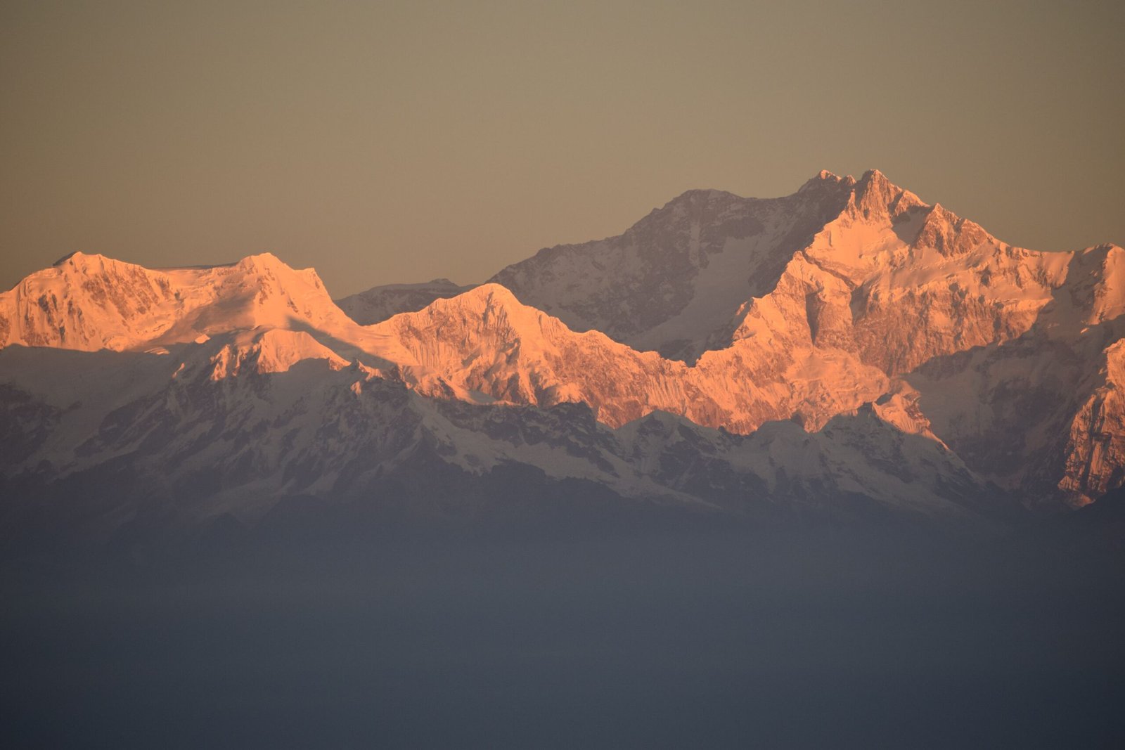
Kanchenjunga North Base Camp Trek
Follow the Ghunsa Valley through Kambachen and Lhonak to Pangpema, beneath the dramatic north face of Kanchenjunga.
EXPLORE →
Kanchenjunga Circuit Trek
A remote Himalayan journey connecting the north and south base camp regions through high passes and secluded valleys.
EXPLORE →HIMALAYAN EXPEDITIONS
Major high-altitude and technical climbing objectives across the Kanchenjunga massif and surrounding eastern Himalaya.
Mount Kanchenjunga Expedition
Climb the 8,586-metre Mount Kanchenjunga, the world’s third-highest mountain, on a demanding expedition in the eastern Himalaya.
EXPLORE →
Yalung Kang Expedition
Pursue Yalung Kang (8,505 m), a formidable high-altitude summit within the Kanchenjunga massif.
EXPLORE →
Mount Jannu Expedition
Explore the highly technical Mount Jannu (Kumbhakarna, 7,710 m), renowned for its steep and challenging alpine terrain.
EXPLORE →
Kirat Chuli Expedition
Attempt Kirat Chuli (Tent Peak, 7,362 m), a remote Himalayan summit on the Nepal–Sikkim border.
EXPLORE →BEST TIME TO VISIT KANCHENJUNGA
Kanchenjunga’s remote eastern Himalayan trails vary sharply with altitude and season. Spring and autumn are the principal trekking windows; winter brings intense cold and snow on high routes, while monsoon rain can affect trails, visibility and access. Plan around your route, elevation and current local conditions.
Spring · Warmer Trails
Spring generally brings milder daytime temperatures and longer daylight. Lower trails may show blooming rhododendrons, while higher routes remain cold and snow conditions vary.
Autumn · Clear Views
After the monsoon, skies often become clearer and conditions are commonly favourable for classic Kanchenjunga trekking, though weather and visibility can still change.
Monsoon · Cloud & Rain
Rain, cloud and reduced visibility can affect trail conditions, road access and flights in the Kanchenjunga region. Monsoon travel requires careful checking and flexible plans.
Winter · Snow & Quiet Trails
Winter can offer quieter trails and crisp views, but temperatures are very low at altitude. Snow or ice may affect high passes, lodges and route access.
Altitude matters: weather and temperature can change quickly between lower settlements, Kanchenjunga North and South Base Camp approaches, and higher camps. Select your travel dates and route for the elevation—not season alone.
VIEW KANCHENJUNGA TREKS →ALTITUDE, DIFFICULTY & ACCLIMATIZATION
Kanchenjunga routes rise from Taplejung and the lower eastern Himalayan valleys toward remote high camps and demanding passes. Understand key elevations, walking effort and acclimatization needs before choosing an itinerary. Difficulty depends on route, season, trail conditions and each trekker’s experience.
Know the high points
Ghunsa
Ghunsa is a traditional village and a common staging point on the Kanchenjunga North Base Camp route. The trail climbs through remote settlements and forest, so a steady pace and suitable itinerary are important.
EXPLORE KANCHENJUNGA TREKS →Kanchenjunga North Base Camp
Kanchenjunga North Base Camp lies in the upper Barun Valley beneath the Kanchenjunga massif. Extra acclimatization time and careful pacing are important at this elevation.
EXPLORE NORTH BASE CAMP →Kanchenjunga North Base Camp
The South Base Camp approach reaches the high viewpoint around Oktang above Ramche. Plan gradual ascent, acclimatization and flexibility for symptoms or weather
EXPLORE KANCHENJUNGA →Sele La Pass
A high pass on the Kanchenjunga North Base Camp approach, crossing demanding terrain in thin air. Conditions, snow and route access require experienced local guidance.
EXPLORE KANCHENJUNGA →Moderate · Lower routes
Regular uphill walking, uneven trails and several hours on foot each day. Fitness and preparation remain important even at lower elevations.
Examples: lower Kanchenjunga trekking approaches.Moderate to challenging
Longer walking days and progressively higher overnight stops require preparation, steady pacing and a carefully planned itinerary.
Examples: Kanchenjunga North Base Camp Trek.Challenging · High altitude
High passes, cold, exposed terrain and rapidly changing weather can make routes strenuous. Conditions may require route or schedule changes.
Examples: Kanchenjunga Circuit and Sele La crossing.Acclimatize Gradually
Give your body time to adjust as sleeping altitude increases. Fitness alone does not prevent altitude illness.
Recognize Early Symptoms
Headache, nausea, dizziness and unusual fatigue can be signs of altitude illness. Do not ascend to a higher sleeping altitude while symptoms are present.
Stop Ascent · Descend if Worse
Worsening symptoms, confusion, loss of coordination or breathlessness at rest need urgent attention. Descend to a lower altitude and seek medical help; do not rely on this page for diagnosis or treatment.
Important: Elevations are approximate route reference points and can vary by source or exact trail endpoint. Difficulty labels are indicative, not a guarantee. Plan against current conditions and individual experience.
VIEW KANCHENJUNGA TREKS →Kanchenjunga Region · People & Living Heritage
Culture, Heritage & Local Communities
Kanchenjunga’s cultural landscape reflects diverse communities across its lower valleys and high mountain settlements. Limbu and other Kirati communities are prominent in lower areas, while Sherpa and Bhote communities live in higher villages such as Ghunsa and Olangchungola. Their traditions, livelihoods and spiritual practices form an important part of the region’s living heritage.
Limbu & Kirati Heritage
Lower valleys around Taplejung and nearby settlements reflect Limbu and wider Kirati heritage, with community rituals, oral traditions, agricultural life and distinctive local customs.
Sherpa & Bhote Traditions
Higher settlements such as Ghunsa and Olangchungola are associated with Sherpa and Bhote communities. Tibetan Buddhist practices are expressed through prayer flags, mani walls, chortens and local observances.
Gompas & Sacred Places
Diki Chholing Gumba and other sacred places are part of the region’s Buddhist heritage and community life. Ask permission before entering sacred spaces or photographing ceremonies.
Livelihoods & Mountain Life
Farming, livestock, forest knowledge and seasonal movement shape daily life. In higher valleys, herding and mountain-pasture traditions remain important to local livelihoods.
ACCOMMODATION & MEALS
On the Kanchenjunga trekking routes, accommodation is generally in locally operated teahouses and basic mountain lodges. Facilities become simpler and more limited in remote, higher settlements; meals are prepared at lodges along the trail, with menus and supplies varying by village and season.
Kathmandu Hotel Stay
Kathmandu offers a wide range of hotels. The hotel category, number of nights and meal basis depend on the selected AEON Kanchenjunga itinerary; city meals may be separate from trekking meals.

Teahouses & Basic Lodges
Trekkers stay in local teahouses and basic lodges in villages such as Sekathum, Amjilosa, Gyabla, Ghunsa, Kambachen and Lhonak on the north route, and settlements along the south route. Facilities differ by stop.

Simple Mountain Rooms
Rooms are generally basic, with beds or sleeping platforms and blankets. Shared toilets and washing facilities are common; hot showers, charging and other services may be limited or offered for an extra cost, especially at higher stops.

Trekking Meals & Menu
Common lodge meals include dal bhat, rice, lentils, vegetables, noodles, soups, potatoes, eggs, porridge and Tibetan-style breads. Menu choices can become fewer at higher and more remote stops; hot drinks are usually available where lodges operate.
AEON travel note: Accommodation quality, room arrangements and services vary by village and lodge on Kanchenjunga routes. Tell AEON about food allergies or dietary requirements before departure. Exact hotel, lodge and meal arrangements are confirmed in the selected itinerary.
SAFETY & RESPONSIBLE TREKKING
A safe Kanchenjunga journey requires careful preparation, awareness of high-altitude and remote-trail conditions, flexibility when weather changes, and respect for local communities and the protected Himalayan environment.
Altitude & Health Awareness
Kanchenjunga routes reach high elevations, including Pangpema North Base Camp at about 5,140 m and viewpoints toward Oktang in the south around 4,700 m. Altitude illness is a serious concern. Watch for headache, nausea, dizziness, unusual tiredness or loss of appetite. Tell your guide promptly; do not ascend with symptoms. Worsening symptoms require descent and urgent medical help.
Guide, Group & Route Awareness
Stay with your guide and group on the planned route. Trails around Ghunsa, Kambachen, Lhonak, Sele La and the southern valleys can be steep, uneven, exposed or affected by landslides and river crossings. Walk carefully, keep the group informed, and avoid solo detours or crossing unsafe sections without local guidance.
Weather & Emergency Planning
Weather in the Kanchenjunga Himalaya can change quickly. Snow, strong wind, poor visibility, landslides or high water can disrupt trails and plans, particularly at high passes and remote sections. Check conditions with your guide each day, carry warm and waterproof layers, and turn back or wait when conditions are unsafe.
Responsible Trekking
Kanchenjunga Conservation Area protects sensitive forests, rivers and wildlife habitats. Stay on trails, carry rubbish out, do not disturb wildlife, and respect local Limbu, Rai/Kirati, Sherpa and Bhote communities, their customs and sacred places. Ask before photographing people or ceremonies.
AEON safety reminder: Arrange travel insurance that explicitly covers your trekking altitude, medical treatment and emergency mountain evacuation. Carry essential personal medication and share relevant health concerns with your guide before departure. This is general guidance, not a substitute for professional medical advice or local instructions.
Kanchenjunga Region · Nature & Biodiversity
Flora, Fauna & Himalayan Wildlife
From the subtropical valleys and forested lower slopes of eastern Nepal to temperate forests, alpine meadows and high mountain terrain around Kanchenjunga, habitats change dramatically with elevation. Kanchenjunga Conservation Area supports diverse plants, birds and rare Himalayan wildlife.

Rhododendron & Alpine Plants
Lower and middle forest belts include rhododendron, oak and other broad-leaved trees. Higher elevations transition to conifers, juniper, shrubs, grasses and seasonal alpine flowers adapted to cold mountain conditions.

Himalayan Tahr
This sure-footed mountain ungulate inhabits steep rocky slopes and alpine terrain in the wider Kanchenjunga landscape. It may be spotted at a distance in suitable habitat, though sightings are never guaranteed.

Snow Leopard
Remote high-mountain habitats of the Kanchenjunga Conservation Area form part of the snow leopard's range. This elusive predator is rarely seen; visitors should observe quietly and never approach or disturb wildlife.

Himalayan Birds
Forest and alpine habitats support rich birdlife, including the colourful Himalayan monal and other pheasants, as well as birds adapted to the region's varied elevations and vegetation zones.
MAKALU REGION – FREQUENTLY ASKED QUESTIONS
Find practical answers about trekking seasons, routes, permits, altitude, accommodation and preparation for a journey in the Kanchenjunga region.
1. What is the best time to trek in the Kanchenjunga region?
Spring (March–May) and autumn (September–November) are generally preferred for trekking, with clearer views and more stable conditions often possible. Weather varies by altitude; the remote Kanchenjunga–Barun valleys can experience changing conditions, so confirm the forecast and trail situation locally.
2. Do I need permits for trekking in the Kanchenjunga region?
The Kanchenjunga Base Camp route enters Kanchenjunga–Barun National Park, so the applicable national-park entry permit is required. Rules and documents can vary with the exact itinerary; confirm current permit and registration requirements before departure.
3. Do I need a licensed trekking guide?
Kanchenjunga is a remote trekking area with challenging terrain and limited services. Trekking with an experienced, properly arranged guide is strongly recommended; current guide, agency and registration requirements should be confirmed for the exact route before departure.
4. How many days do I need for a Kanchenjunga trek?
The Kanchenjunga Base Camp Trek commonly takes around 18–24 days, depending on access, itinerary, pace and acclimatization. Kanchenjunga North, South or Circuit itineraries may take a different length of time. Allow flexibility for remote-trail conditions and safe altitude adjustment.
5. How difficult are the Kanchenjunga trekking routes?
Kanchenjunga routes are generally challenging to strenuous because of long walking days, steep trails, remote terrain, high elevations and limited facilities. The Kanchenjunga Base Camp journey is best suited to trekkers with good fitness and preparation; choose a route according to experience and available time.
6. Can altitude sickness affect me in the Kanchenjunga region?
Yes. Kanchenjunga Base Camp is approximately 5,140 m, and high passes and viewpoints can exceed 5,000 m. Altitude illness can affect anyone. Symptoms include headache, nausea, dizziness and unusual fatigue. Tell your guide immediately; never ascend with symptoms, and seek prompt descent/medical help if they worsen.
7. What type of accommodation is available on the trails?
Kanchenjunga routes have basic teahouses and local lodges in established villages, but facilities are more limited than on busier trekking routes. Rooms, toilets, hot showers, charging and food choices vary by settlement; remote/high sections have fewer services and simpler accommodation.
8. What food can I expect during the trek?
Local lodges commonly serve dal bhat, rice, noodles, soups, potatoes, vegetables, eggs and other simple meals. Menus become more limited in remote and higher settlements because supplies are carried in. Share dietary needs with AEON before the trek.
9. How do I reach the Kanchenjunga trekking routes?
Kanchenjunga trekking access commonly involves travel from Kathmandu toward the Taplejung / Suketar–Mitlung trail access area by flight and/or road, followed by overland transfers to the trailhead (often Sekathum). Access arrangements can change with road and flight conditions, so confirm the current approach for your itinerary.
10. What should I pack for a Kanchenjunga trek?
Pack broken-in trekking boots, layered clothing, warm insulation, waterproof jacket and trousers, sun protection, reusable water bottles, personal medicines and a first-aid kit. Include a suitable sleeping bag and cold-weather gear; exact equipment depends on season, altitude and porter arrangements.
11. Do I need travel insurance for a Kanchenjunga trek?
Comprehensive travel insurance is essential for a remote Kanchenjunga itinerary. Confirm coverage for trekking at the itinerary's maximum altitude, medical treatment and emergency evacuation (including helicopter evacuation where available). Read exclusions and carry policy and emergency contacts.
12. Can my Kanchenjunga itinerary be customised?
Yes. The itinerary can be tailored to available days, route preference, walking pace and experience, subject to access, permits, weather and safety. Because Kanchenjunga is remote, plans should include suitable acclimatization and contingency time.
AEON planning note: Trekking rules, access conditions and local services can change. Final arrangements should always be confirmed for the Kanchenjunga route and travel dates. These answers are general planning guidance and do not replace current official instructions or advice from your trekking guide.
Kanchenjunga Region · Route & Location
Kanchenjunga Region Trekking Map
Explore the Kanchenjunga Conservation Area, the North and South Base Camp trekking regions, and nearby access settlements in eastern Nepal.
Not booked your next holiday yet?
Let our travel experts help you plan an unforgettable trip. We know the Himalayas well and can help you choose the right places and experiences for your journey. We’ll make sure your trip fits your interests, schedule, and budget. If you’re ready for a beautiful adventure in the Himalayas, get in touch with us today.


